- You are here:
-
Home

-
News & Events
- Uncategorised
Photo Gallery
- Details
Photo Gallery
- Details
Photo Gallery
- Details
Things to do in Stonehenge
- Details
John Egan Pioneer Track
 Follow the scenic John Egan Pioneer 4WD track to discover the magnificent landscapes. The track's namesake, John Egan, was a local war hero who served in WWII in three areas of conflict - Egypt, Cyprus and Papua New Guinea. The track is located half way between the north and south Stonehenge exits on the road to Jundah. The track is an 8km 4WD track where you see many spectacular views. It takes about 20 minutes drive to complete the track, although allow time to have smoko along the way.
Rock Holes
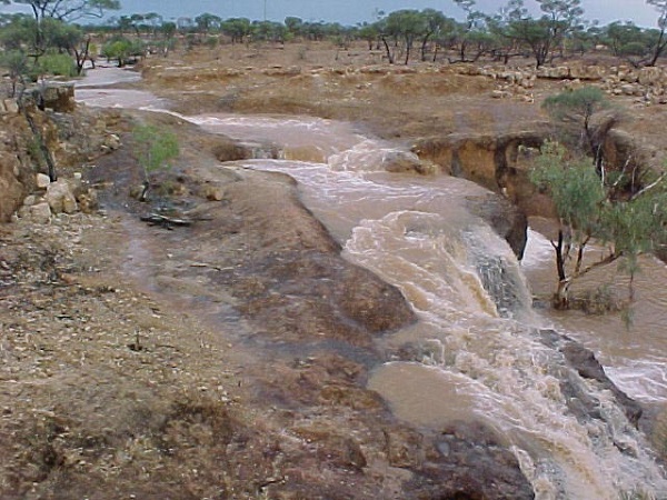 Along the road as you head towards Longreach from Stonehenge, on the right hand side of the road, you'll see the raims of a white tyre hanging in the tree (like a back-to-front-'C'). Follow the bush track along until you reach the Stonehenge Rock Holes. These Rock Holes are shaded by the ghostly white gum trees. When it rains, the holes are filled with clear water. The Stonehenge Rock Holes are used as a swimming hole by the locals when it rains.
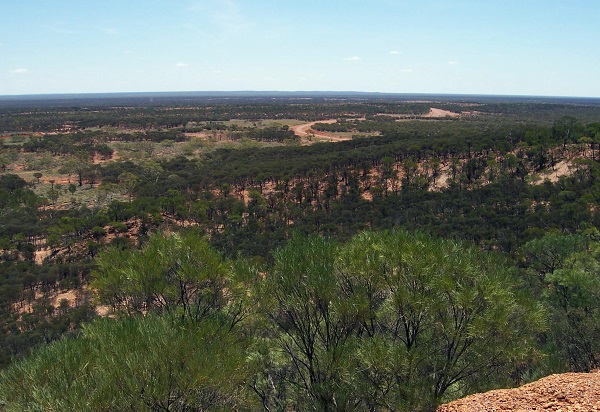
Swanvale Lookout
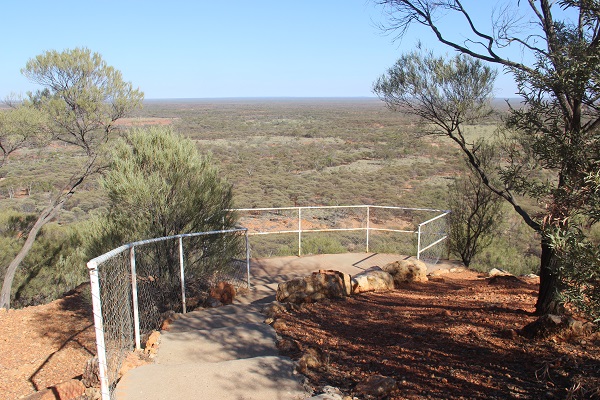 Situated half way between Stonehenge and Jundah. At the top of the “jump up”, a rest area offers scenic views and a great place to enjoy the sun setting into the western horizon. Looking East from the Jump Up you take in the Johnstone Ranges which run between the Thomson and Barcoo Rivers. To the West of the Jump Up you will see the homestead of Glenariff and the tree line of the Thomson River beyong. Did you know that the Swanvale Lookout offers free camping?
Stonehenge Address Book
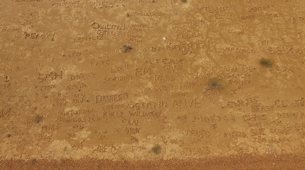 Have you ever seen an address book entirely made of stones? Just a short 2km drive from Stonehenge towards Longreach (coming from Stonehenge) on the left hand side of the road, you will see the Stonehenge Address Book. Keep an open eye for a wide area of flat top rock country covered in stones. The Stonehenge Address Book began years ago when the local mail man Mr Johnny Weston was stranded by is broken down truck. Whilst waiting to be rescued Mr Weston wrote 'Jundah' in stones. If you're travelling past pull off to the side of the road, collect some stones and leave a message or your name for future travellers.
XXXX Hill
Take advantage of the 360 degree views whilst stopping off at the XXXX Hill. You'll see sweeping views of the Thomson River flood pains and Johnstone Ranges. To capture the spectacular landscape by setting your camera to 'pano' mode.
Things to do in Windorah
- Details
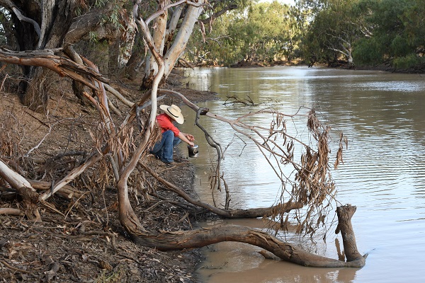
Cooper’s Creek
The best free camping spot around Windorah. The camping ground has plenty of room with bush camping sites along both sides of the creek upstream and downstream of the bridge. There are toilets on the eastern side of the bridge. Most sites overlook the creek. The Cooper is used for canoeing, fishing and birdwatching, it is the perfect place to relax. You'll be pleased to know that open fires are permitted.
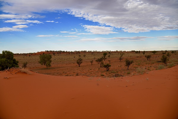
Red Sandhills
The Windorah Red Sandhills are located 12km to the West of town on the Birdsville Road. Make sure you come prepared with your favourite sunset drinks and nibbles so you can really soak up the serenity of the perfect sunset location. If you're taking the kids to the Sandhills, they'll be sure to burn off some energy as they run up and down the dunes. Capture the experience with your camera to cherish the true outback experience forever. Please be sure to remove any rubbish and leave this spot exactly how you find it.
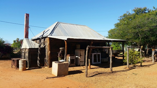
Whitula Gate Museum
Wander through the restored 1900’s slab hut which was built by the Rabbit Board as a boundary hut on Whitula Creek, west of town.
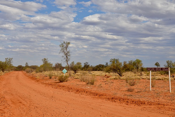
12km Nature Drive
The 12km unsealed Nature Drive winds it's way through the different landscapes between Windorah Township and Coopers Creek. 45 plants have been indentified and signposted along the drive. The Coopers Creek floodplain has a number of distinctly different plant communities including coolabah woodlands, alluvial heerb land, lignum shrub land, gidgee open woodland and spinifex grassland.
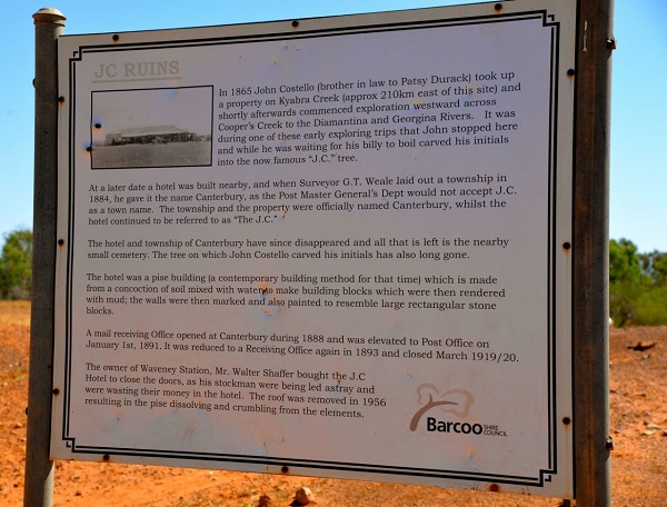
The J.C. Ruins
Imagine what life was like in the township of Canterbury while you explore the ruins of the J.C. Hotel and cemetery, 80km west of Windorah.
Solar Farm
Located 2km East of Windorah on the Quilpie Road is the Windorah Solar Farm. The Solar Farm is expected to save up to 100,000 litres of diesel fuel per year. The total cost of this project was $4.5 million with $1 million being provided by the Federal Government. Each of the five solar dishes have 112 square mirrors. The Solar Farm was opened in December of 2008.

Information and History Walk
The Information and History walk/drive around the town of Windorah is a great way to learn about the points of interest around the town. You will learn about the old court house which is now an icon of the town, to discovering the beautifully maintained and unique town cemetery.
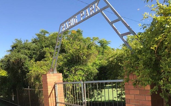
Rabig Park
Established in 1980, Rabig Park was names after long serving Councillor, Mr Merv Rabig and is located next to the Windorah Visitor Information Centre. The park provides an area to sit and enjoy a rest, there is a covered playground, there is also a life sized snakes and ladders game to play - call into the Visitor Information Centre to borrow the dice to play.
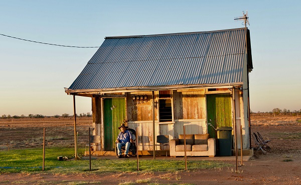
The Old Courthouse
One of Windorah's best known characters is local resident, Tar Pot. Tar has worked as an outback drover for most of his life. Now he enjoys sitting on the front porch of his on room house, ready for a yarn. Believe it or not, Tar Pot's house was originally the local Police Station courthouse that was reloacted for his use. If you see Tar Pot on his porch be sure to pop in and say hello and he loves a good yarn.